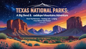
Exploring Texas National Parks: A Guide to Big Bend and Beyond

Exploring Texas National Parks: A Guide to Big Bend and Beyond
Introduction
Texas is a land of extremes—where rugged desert expanses meet soaring mountain peaks, and the night sky blazes with stars. From the sweeping vistas of Chihuahuan Desert to the dramatic canyons cut by the Rio Grande, Texas National Parks offer landscapes unlike any other in the U.S. This guide delivers a deep dive into Big Bend National Park—covering hiking, stargazing, lodging, wildlife, and more—plus a spotlight on nearby Guadalupe Mountains National Park. With practical road-trip itineraries, packing lists, and a handy plan-it tool (the Free Micro Task Tracker), you’ll be ready to experience the magic of West Texas fully.
1. Why Visit Texas National Parks?
Unique Appeal
Texas’s national parks showcase remarkable ecological variety: arid desert, rugged mountain terrain, and remote solitude. Unlike the more crowded parks of the West, these gems offer a rare blend of adventure, culture, and star-filled night skies.
Big Bend National Park
As the crown jewel of West Texas, Big Bend straddles the Rio Grande and spans desert, mountains, and river ecosystems across roughly 800,000 acres National Parked+3National Park Service+3WorldAtlas+3. Its nickname as the least-visited U.S. park speaks to the solitude and raw beauty awaiting explorers.
Guadalupe Mountains National Park
Just a few hours away, Guadalupe Mountains is known for its rugged peaks—the highest in Texas—and a network of trails that penetrate serene canyons and mixed forests WikipediaWikipedia.
2. Exploring Big Bend National Park
Overview of Big Bend
Located in remote West Texas, bordering Mexico, Big Bend covers 801,163 acres (1,252 sq mi) National Park Service+1National Parked+1. Despite its enormity, it’s one of the least-crowded national parks, offering remarkable solitude and nature immersion.
Hiking Trails in Big Bend
-
Beginner-Friendly
-
Chisos Basin Loop (1.8 mi): Easy mountain views—great for families.
-
Window View Trail (0.3 mi): Short hike to a classic viewpoint at sunset.
-
-
Moderate
-
Lost Mine Trail (4.8 mi): Stunning panoramas of Casa Grande and Chisos Mountains DarkSky International+9WorldAtlas+9Southern Living+9.
-
Santa Elena Canyon Trail (1.7 mi): Walk along the Rio Grande beneath soaring canyon walls.
-
-
Challenging
-
South Rim Trail (12–14.5 mi): All-day trek with commanding views over the desert-mountain interface.
-
Emory Peak (10.5 mi round-trip): Summit of Big Bend at ~7,825 ft Southern Living+4WorldAtlas+4National Park Service+4.
-
Hiking Tips:
Bring 1 gal/person/day, sunscreen, hats, and durable boots—this is remote terrain with sparse shade.
Stargazing Opportunities
Big Bend achieved International Dark Sky Park status in 2012, earning a Gold Tier designation as one of the darkest skies in the continental U.S. Wikipedia+2National Park Service+2EarthSky+2. Wilderness sites like Chisos Basin and Sotol Vista provide prime vantage points.
-
Best Spots: Chisos Basin (high elevation), Sotol Vista (wide desert sky).
-
Activities: Ranger-led sky programs, DIY Milky Way photography.
-
Pro Tips: Use a red flashlight, warm layers, and star-chart app for navigation.
Wildlife & Nature
Look for roadrunners, javelinas, rattlesnakes, and seasonal wildflowers. Always keep your distance, avoid feeding wildlife, and stay alert on trails.
3. Nearby Stays and Accommodations
Inside the Park
-
Chisos Mountain Lodge: The only in-park lodging with basic rooms and stunning ridge-top views.
-
Campgrounds:
-
Chisos Basin: Ideal for easy trail access and starry nights.
-
Rio Grande Village: Suited for river activities.
-
Cottonwood: Quieter and less crowded.
-
(Reserve early during spring/fall for prime dates.)
Outside the Park
-
Terlingua: A quirky boomtown offering glamping tents, Airbnb casitas, and Terlingua Ranch Lodge.
-
Marathon: Homey stay at the Gage Hotel.
-
Alpine: Larger town with more amenities, hotels, and restaurants.
Tip: Choose accommodation based on entrance proximity and amenities—remote areas may lack Wi‑Fi and cell.
4. A Nod to Guadalupe Mountains National Park
Overview
About a 3½‑hour drive from Big Bend, this park is home to Guadalupe Peak (8,751 ft), the highest point in Texas Southern Living+10WorldAtlas+10Wikipedia+10National Park Service+1TIME+1Southern LivingDaily Passport+15Wikipedia+15Wikipedia+15.
Key Attractions
-
Guadalupe Peak Trail: 8.4 miles round‑trip with ~3,000 ft elevation gain trailgroove.com.
-
Devil’s Hall Trail: 4.2 mi hike through scenic rock formations.
-
McKittrick Canyon: Famous for fall foliage (October–November).
-
El Capitan: Iconic limestone formation seen from highways; peak rises over 8,000 ft Southern LivingWikipedia+1Southern Living+1Wikipedia+3Wikipedia+3Wikipedia+3.
Why Visit
Guadalupe offers striking high-altitude hikes, fossil-limestone scenery, and fewer crowds—making it the perfect complement to Big Bend’s desert wilderness.
5. Planning a Park‑Focused Road Trip
Route Planning
Sample 6-Day Itinerary:
-
Fly into El Paso or Midland/Odessa.
-
Explore Guadalupe Mountains (hike Guadalupe Peak).
-
Drive to Big Bend via Highway 118.
4–5. Big Bend adventures. -
Return to airport via Alpine.
Driving Tips
Long travel stretches, limited gas and cell coverage—download offline maps and plan refuel stops.
Best Times to Visit
Spring (Mar–May) and Fall (Sep–Nov) offer mild daytime temps and comfortable nights. Summer is too hot, winter brings cold nights.
Packing Essentials
-
Hiking gear: Boots, hat, sunscreen, hydration.
-
Stargazing gear: Blanket, red flashlight, apps.
-
Road-trip kit: Cooler, maps, emergency kit, extra cash.
Budget Tips
National Park Annual Pass ($80) covers both parks. Save by camping or staying in budget towns like Fort Stockton.
Safety Tips
Monitor flash-flood alerts, inform someone of your route, and carry cash for small businesses.
6. Practical Tips and Resources
Entry Fees
-
Big Bend: $30/vehicle (7-day) Southern Living+1britannica.com+1WorldAtlas+1Daily Passport+1
-
Guadalupe Mountains: $10/vehicle (7-day) Wikipedia
(Check NPS for updates.)
Getting There
-
Airports: Midland/Odessa (~3–4h to Big Bend), El Paso (~4h to Guadalupe).
-
Car Rental: Essential for travel flexibility (4WD not required for main roads).
Helpful Resources
-
Official NPS Sites: nps.gov/bibe, nps.gov/gumo
-
Apps: AllTrails (hikes), NPS App (visitor alerts), SkySafari (stargazing).
Cultural and Historical Notes
Big Bend sits on ancestral lands and the U.S.–Mexico border—visit Boquillas crossing (W-Su). Nearby Marfa offers an arts scene; Fort Davis, a historic frontier outpost.
Conclusion
Texas national parks offer raw beauty, quiet reflection, and adventure. From the desert-mountain contrast of Big Bend to the sky-high trails of Guadalupe Mountains, this trip promises unforgettable landscapes, star-scattered nights, and remote charm.
Plan Your Trip with the Free Micro Task Tracker 🌟
Ready to make this adventure happen? Download the Free Micro Task Tracker—your personal digital planner to break down big trips into manageable steps:
-
Create a road-trip schedule (flights, drives, hikes)
-
Track reservations (lodging, permits, park entry)
-
Manage gear checklists (hiking, stargazing, safety)
-
Set road-trip alerts (weather, flash floods, trail openings)
🗺️ Call to Action:
Install the Free Micro Task Tracker today, then start a “Texas National Parks Road Trip” project. Your future self will thank you when it’s all planned—and stress-free.
When you’re under Big Bend’s star-swept sky or standing atop Guadalupe Peak, you’ll feel the grandeur of Texas’s wild places. Disconnect to reconnect, and embrace an adventure that truly feels big.
Further Reading & Sources
-
Big Bend’s Dark Sky designation & park stats
-
Guadalupe Peak details and park overview